Contents
Overview
The Landsat program, a joint venture between NASA and the U.S. Geological Survey, represents a critical, continuous stream of data that underpins global change research, environmental monitoring, and resource management. Its advanced multispectral imaging capabilities, building on decades of precedent set by Landsat 1 (originally ERTS-1), provide invaluable insights into everything from agricultural health and deforestation rates to urban sprawl and disaster response. The sheer volume of data collected by the Landsat program, now exceeding millions of images, forms an unparalleled historical archive, allowing scientists to track Earth's transformations over time. Landsat 9's enhanced resolution and spectral bands offer even greater detail, pushing the boundaries of what we can observe and understand about our dynamic planet.
🎵 Origins & History
The genesis of the Landsat program traces back to the early 1970s, a period of burgeoning environmental awareness and technological ambition. The launch of ERTS-1 on July 23, 1972, marked a paradigm shift, establishing the precedent for continuous, systematic Earth observation from space. Renamed Landsat 1 in 1975, it laid the groundwork for a legacy that would span decades and multiple satellite generations. Each subsequent mission, from Landsat 2 through Landsat 8, incrementally improved sensor technology and data acquisition strategies. This sustained effort, driven by the vision of scientists like William T. Pecora who advocated for Earth resource studies from space, has created an unbroken data record unparalleled in its scope and duration, providing a vital historical context for understanding planetary change.
⚙️ How It Works
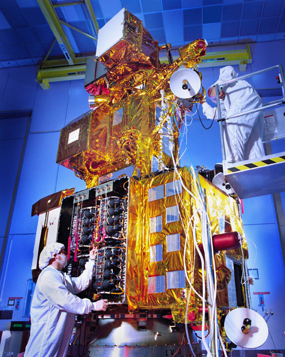
Landsat 9 operates by capturing reflected sunlight and emitted thermal radiation from Earth's surface across multiple spectral bands. Its primary instruments, the Operational Land Imager 2 (OLI-2) and the Thermal Infrared Sensor 2 (TIRS-2), are designed for high fidelity. OLI-2 detects visible, near-infrared, and short-wave infrared light, providing detailed imagery of land cover, vegetation health, and water bodies. TIRS-2 measures thermal infrared energy, crucial for assessing surface temperature, water stress in agriculture, and urban heat island effects. The satellite orbits in a polar, sun-synchronous path, ensuring it passes over the same location on Earth every 16 days, capturing images with a spatial resolution of 30 meters for most bands, allowing for detailed analysis of features on the ground.
📊 Key Facts & Numbers
The Landsat program, with Landsat 9 as its current flagship, has amassed an astonishing archive of over 10 million images since its inception. Landsat 9 itself collects approximately 700 scenes per day, contributing to a global data stream that is freely accessible to the public. The operational cost of the Landsat program, managed jointly by NASA and the U.S. Geological Survey, is estimated to be in the hundreds of millions of dollars per mission, a significant investment yielding immense scientific and economic returns. Landsat 9's data is distributed in standardized formats, with scenes typically covering an area of 170 x 183 kilometers (106 x 114 miles), ensuring compatibility and ease of use for researchers worldwide. The program's commitment to open data access has fostered innovation, with an estimated economic benefit of over $1.7 billion annually attributed to its use.
👥 Key People & Organizations
The Landsat program is a testament to the collaborative spirit between government agencies and the scientific community. Key figures like William T. Pecora, former Director of the U.S. Geological Survey, championed the concept of Earth observation from space, laying the intellectual foundation for the program. James C. Fletcher, NASA Administrator during the early stages, was instrumental in securing the necessary funding and political support. Today, the program is overseen by leadership within both NASA's Goddard Space Flight Center and the U.S. Geological Survey's Earth Resources Observation and Science (EROS) Center. Countless scientists, engineers, and data analysts at universities and research institutions globally, such as those at University of Wisconsin-Madison and Stanford University, rely on and contribute to the interpretation of Landsat data.
🌍 Cultural Impact & Influence
The influence of Landsat imagery extends far beyond scientific journals, permeating global culture and public awareness of environmental issues. Iconic images of Earth from space, often derived from Landsat data, have shaped our collective consciousness, fostering a sense of global stewardship, famously captured in the "Blue Marble" photograph taken during the Apollo 17 mission, though Landsat provided the ongoing, systematic view. The program's commitment to open data has democratized access to Earth observation, empowering citizen scientists and journalists to report on environmental changes. Its imagery has been featured in documentaries, educational materials, and even art installations, making the invisible processes of our planet visible and relatable to a broad audience, influencing public policy and environmental advocacy movements.
⚡ Current State & Latest Developments
As of late 2024, Landsat 9 is fully operational and providing high-quality data, working in tandem with its predecessor, Landsat 8, to achieve a four-day revisit frequency over the United States. This enhanced temporal resolution is a significant upgrade, allowing for more timely monitoring of dynamic events like wildfires, floods, and agricultural crop cycles. NASA and the U.S. Geological Survey are actively processing and archiving the incoming data, ensuring its availability through platforms like EarthExplorer. Plans are already underway for the next generation of Landsat satellites, with discussions focusing on incorporating even more advanced sensor technologies and potentially expanding spectral coverage to address emerging scientific questions and societal needs.
🤔 Controversies & Debates
The Landsat program, while widely lauded, is not without its points of contention. A persistent debate revolves around the balance between sensor resolution and data accessibility. While higher resolution data can offer finer detail, it also raises concerns about potential misuse for surveillance and privacy violations, a tension that has been present since the program's inception. Furthermore, the long-term funding and sustainability of such a large-scale, multi-decade program are subjects of ongoing discussion within governmental budget cycles. Critics sometimes point to the 16-day revisit time of individual satellites as a limitation for monitoring rapid environmental changes, though the combined coverage of Landsat 8 and 9 mitigates this significantly.
🔮 Future Outlook & Predictions
The future of Landsat is inextricably linked to the evolution of Earth observation technology and the increasing urgency of global environmental challenges. Projections suggest that future Landsat missions will likely incorporate artificial intelligence and machine learning for automated data analysis and anomaly detection, moving beyond raw imagery to actionable intelligence. There's also a growing emphasis on integrating Landsat data with other satellite constellations, such as Copernicus Sentinel missions, to create even more comprehensive global monitoring systems. The program's enduring legacy points towards a continued role in providing a consistent, reliable baseline for understanding climate change impacts, resource management, and the long-term health of the planet for decades to come.
💡 Practical Applications
The practical applications of Landsat 9 data are vast and touch nearly every sector concerned with land and resource management. In agriculture, it aids in precision farming, monitoring crop health, estimating yields, and optimizing irrigation, contributing to global food security. Foresters use it to track deforestation, monitor forest health, and manage timber resources sustainably. Urban planners leverage Landsat imagery to monitor population growth, map urban sprawl, and assess infrastructure development. Emergency responders utilize it for disaster assessment and damage mapping following events like hurricanes, floods, and wildfires, enabling more effective aid distribution and recovery efforts. Geologists and hydrologists employ it to study landforms, map water resources, and monitor changes in glaciers and ice sheets.
Key Facts
- Category
- technology
- Type
- topic